Climate Matters•December 19, 2018
Holiday Warming & Extremes
It’s that time of year when people are wondering about their chance for a white Christmas. Despite historic, early-season snow from Calgary, Alberta to Roanoke, Virginia, the overall snow-covered area in North America is shrinking as temperatures rise with climate change.
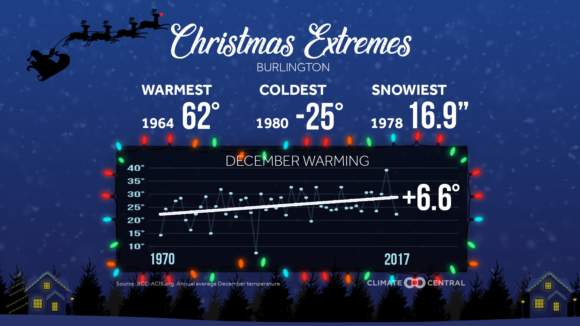
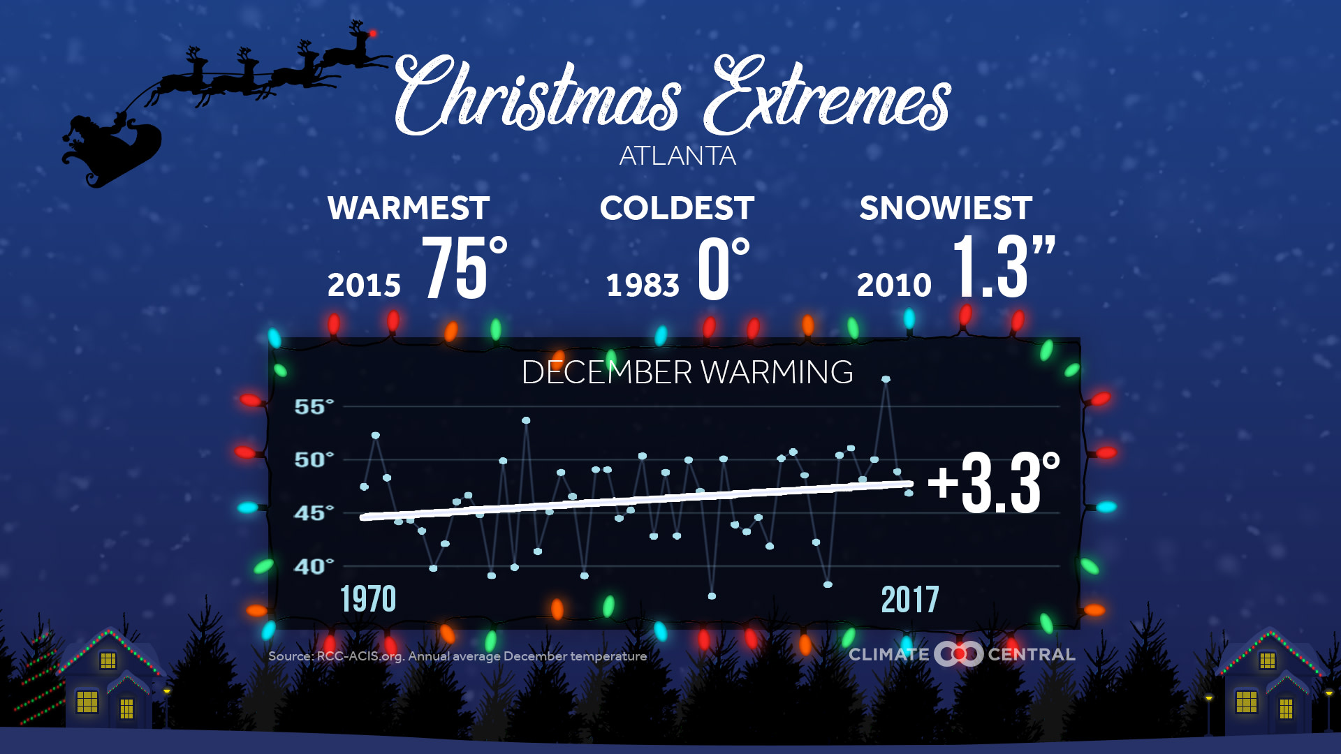
The U.S. December temperature average has climbed just over 2oF in the last half-century. Over two thirds of the 244 cities analyzed have warmed at least 1oF since 1970, while only 3 percent have cooled 1oF. And several northern cities have warmed more than 6oF, including Burlington, Vermont; Fargo, North Dakota; and Presque Isle, Maine. This warmer weather can lead to more winter precipitation falling as rain, as shown in a Climate Central report.
But even with rising temperatures, we still get snow and rounds of extreme cold. In fact, the snowiest Christmas on record dumped an incredible 21 inches in Erie, Pennsylvania last year. And as our snow & ice toolkit explains, a warmer atmosphere will increase the moisture that leads to precipitation. So even though temperatures are stacking the deck against a white Christmas, there’s still a chance of drawing some wintry weather where temperatures are cold enough.
Methodology: Christmas temperature extremes and December temperature trends are calculated using data from the Applied Climate Information System. Extremes are given for each station’s entire period of record, whiletrends begin in 1970 for consistency between stations. Displayed trend lines are based on a mathematical linear regression. A White Christmas is defined as having at least 1” of snow depth, based on analysis of the 1981-2010 NOAA/NCEI climatological normal. For more details, see our previous releasehere.