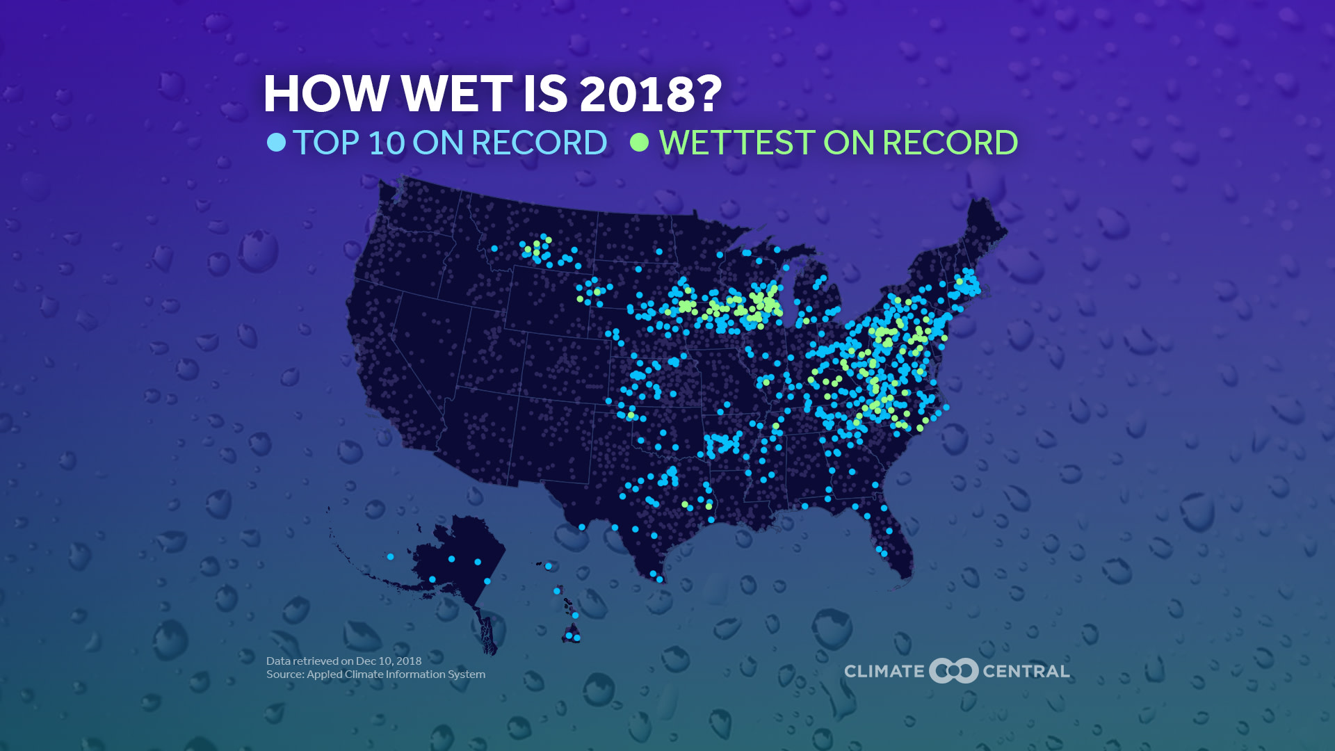
At 2:40PM on May 27, the National Weather Service issued a flash flood warning to the residents of Ellicott City, Maryland, west of Baltimore. Less than three hours later, a torrent of water gutted the city’s historic center — the second time since 2016 that extreme precipitation devastated Ellicott City’s old town. 2018 is on track to be the wettest year on record for the Baltimore area. There, and in many other parts of the country, heavy rainfall has become more common as the climate has warmed.Of 2,800 stations analyzed by Climate Central, 133 (across 21 states) saw record precipitation totals this year, and 685 saw yearly totals that were among the top 10 on record. 2018 is already the fifth-wettest year on record in the contiguous U.S.
Warmer air holds more moisture. Earlier analysis by Climate Central showed that 42 of the 48 states in the contiguous U.S. will see increased runoff risks from heavy rain by 2050. Heavy rain can damage or destroy infrastructure, homes, and businesses. It jeopardizes public health, washing sewage into waterways, kicking up polluting sediments, and creating habitats for disease-carrying insects. By laying down impermeable surfaces like asphalt, communities and developers have limited the soil’s ability to absorb precipitation.
Just as climate change has made heavy rainfall more common in some areas, so has it encouraged droughts in others. As temperatures continue to climb from increasing greenhouse gas emissions, evaporation rates also increase. The higher evaporation rates dry out land surfaces faster, making droughts worse. Warmer temperatures can also cause more winter precipitation to fall as rain rather than snow, diminishing the store of snowpack whose slow melting many communities rely on for their water.
Methodology: Daily precipitation data was retrieved on December 10 from the Applied Climate Information System (www.rcc-acis.org) for the years with the lowest annual total, highest annual total, and 2018. Data was summed over the year to show a running total for each city. For the national map, annual precipitation data was collected and ranked for more than 2,000 stations.
