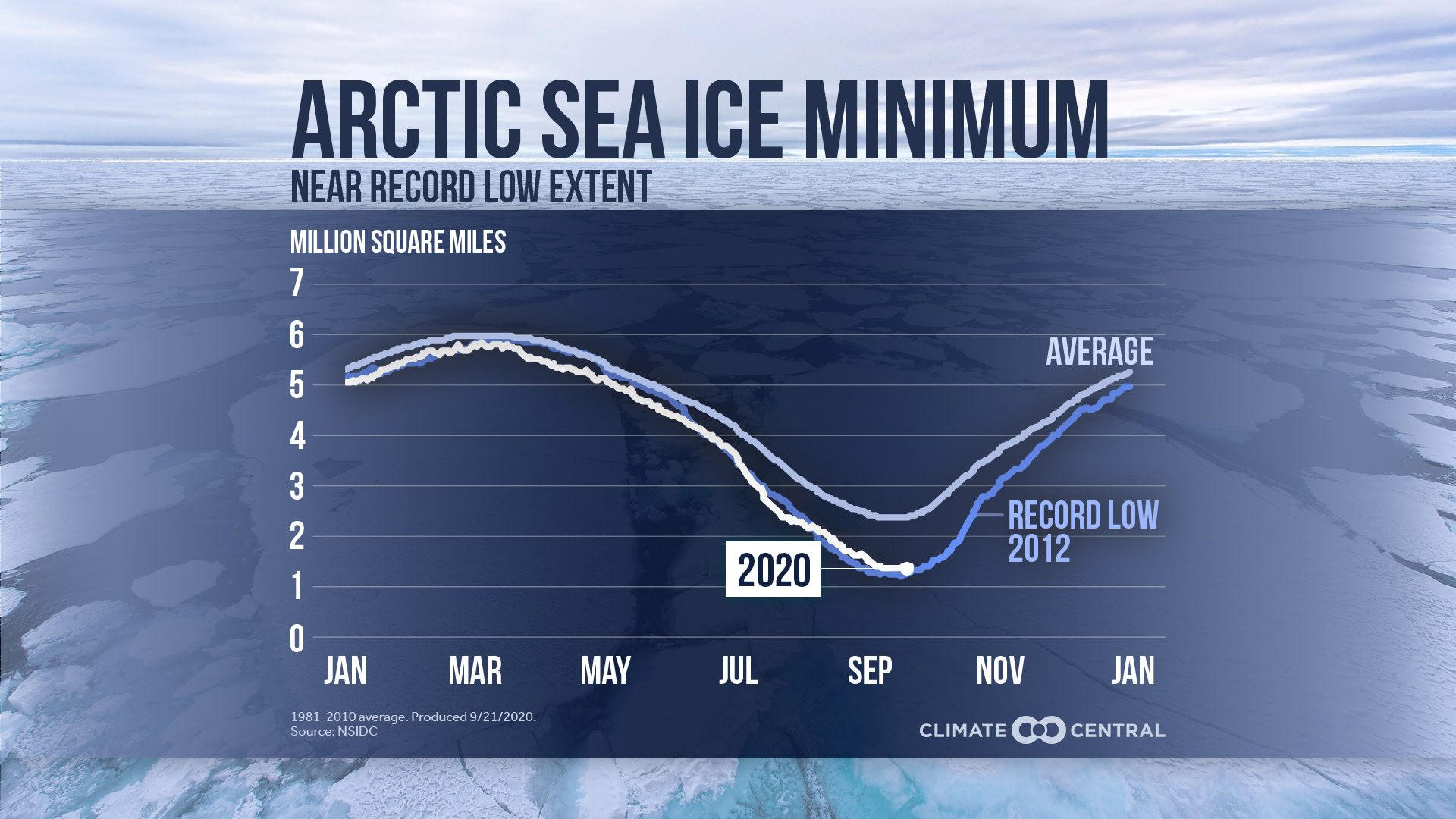
Second Lowest on Record
JPG:WITH Title • WITHOUT Title
PNG:WITH Title • WITHOUT Title
Arctic sea ice likely reached its minimum extent for the year, 1.44 million square miles, on September 15. The 2020 minimum is the second lowest in the nearly 42-year satellite record according to the National Snow and Ice Data Center (NSIDC). That extent is about 46% of the area of the 48 contiguous states. A Siberian heat wave began this year’s Arctic sea ice melt season early, and with Arctic temperatures 14°F to 18°F warmer than average, the ice kept melting.
Arctic ice loss is leading to a reinforcing heat spiral. When ice melts and exposes the open ocean, the darker ocean surface absorbs more heat, which then leads to more ice loss, continuing the feedback loop. This contributes to the Arctic regions warming twice as fast as the rest of the planet.
Additional statistics:
The 2020 minimum is about 969,000 square miles below the 1981-2010 average minimum extent, which is equivalent in size to roughly the states of Alaska, Texas, and Montana combined
The 14 lowest extents in the satellite era have all occurred in the last 14 years.
The record lowest extent occurred in 2012.
Additional resources:
Shareable graphics and data at Climate Central’s Media Library
Quick Facts on Arctic Sea Ice (NSIDC)
