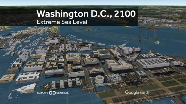
Easily access all visuals, including high resolution Google Earth stills, animated GIFs, and a 3D video flyover here >>
In January, NOAA published a series of new sea level rise projections for the U.S. coast. The extreme scenario reflects recent research suggesting that some segments of the Antarctic ice sheet may collapse more rapidly than scientists had previously thought, particularly if emissions of heat-trapping gases such as carbon dioxide and methane remain high.
The scenario points to 8.25 feet of global average sea level rise by the end of the century. However, local effects, including sinking land and the way that Antarctic ice loss would reshape the Earth’s gravitational field, would lead to 10 to 12 feet of rise for U.S. coastal states other than Alaska.
This scenario would submerge land where at least three-quarters of Norfolk, Miami, and Ft. Lauderdale residents live today. New York, Boston, Virginia Beach, and St. Petersburg are among the other cities with at least 100,000 people in areas at risk. All told, more than 12 million Americans and $2 trillion in property sit below the projected water levels.
Climate Central’s report includes numbers for many more affected U.S. coastal cities and downloadable tables for all of them, as well as state-level information.
METHODOLOGY: Climate Central used NOAA’s localized extreme sea level projections for 2100, NOAA tidal models, and lidar-based (laser-based) land elevations to identify land that could fall below the future high tide line. Low-lying areas that existing levees, ridges or other features appear to isolate from the ocean at this level were excluded. Coastal area population and property value data were overlaid against the remaining at-risk areas and totaled by city, state and nationally.
