Climate Matters•June 12, 2013
Changing Rainfall Patterns
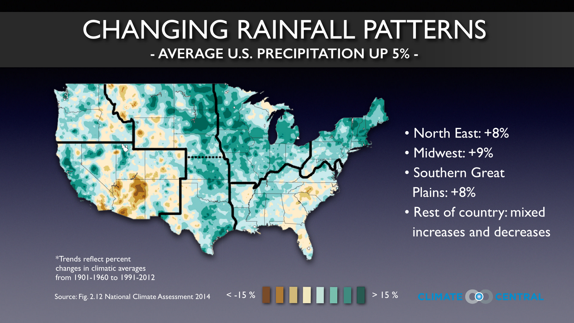
Torrential, record-setting rainfall has pummeled parts of the nation the past few weeks - with more on the way. From the Midwest to Florida to the Eastern Seaboard, the rain has come in different waves from different storms but is producing the same flooding problem. If you feel like there is more rain than there used to be, you are correct. As the graphic shows, overall precipitation for the continental U.S. is up five percent.
Even with the national rainfall total on the rise, there are major regional variations that we need to draw your attention to. For example, parts of the West and Southwest have seen a drop in their average precipitation, with sections of Arizona down 15 percent - only worsening drought conditions in these places. But the Northeast and Southern Great Plains have both received an eight percent rise in their precipitation total, while the Midwest's rainfall rise is up nine percent - the same region that has swung from flood to drought to flood in the span of three years. There is even a swath of land from North Dakota down to Oklahoma where rainfall amounts have risen by as much as 15 percent.
Not only is the annual precipitation average on the rise nationally, the extra rain is coming down from just the kinds of downpours that have filled basements, flooded out roadways, and sent rivers and creeks over their banks recently. (We covered the rise in extreme precipitation in a previous Climate Matters Alert that you can revisit through our archives page).
While there is natural variation in weather patterns, a warming globe and the buildup of heat-trapping greenhouse gases has created an atmosphere that holds more moisture. This means there is more moisture available to fall back down.